

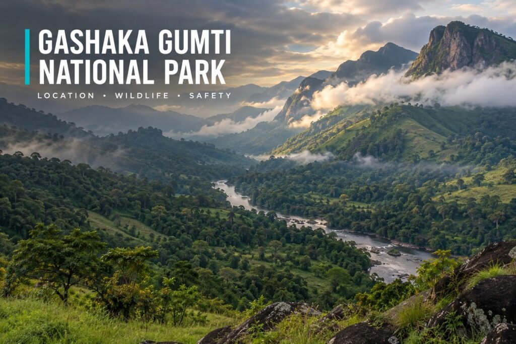
Gashaka Gumti National Park is the largest national park in Nigeria, and it protects the country’s biggest population of wild chimpanzees along with forests, rivers and high mountains. It is also remote and hard to reach, and it lies in a region where travel advice is cautious, so it needs careful planning.
This guide explains where the park is, what lives there, how visitors reach it and what to check before you go. Published information on fees and bookings is thin, and some of my sources are several years old, so I mark what is current and what is not, and I give the safety position before the practical details.
Gashaka Gumti National Park at a Glance
The park lies in the east of Nigeria, along the border with Cameroon. It was created in 1991 by joining two game reserves, and it protects savannah in the north and forested mountains in the south. The table gives the main facts.
| Item | What is known |
|---|---|
| Size | About 6,402 square kilometres |
| States | Taraba and Adamawa |
| Created | 1991, from two game reserves |
| Highest point | Chappal Waddi, 2,419 metres, the highest mountain in Nigeria |
| Best known for | Chimpanzees, mountain scenery and rare birds |
| Entry fee | I could not find a published fee |
| Best season | Mid-December to mid-May, the dry season |
Before planning a trip, read the safety section below. The park is an expedition destination and not a day trip, so plan for a guide, a vehicle built for rough roads and a good deal of patience.
Gashaka Gumti National Park Location, Map and Size
Anyone looking for the gashaka gumti national park location should start with Taraba State, where the main access town of Serti is found, although the park also extends into Adamawa State. It lies on the border with Cameroon, and the highway from Serti runs towards Gembu on the Mambilla Plateau. A visitor who searches for the gashaka gumti national park taraba entry point will be sent to Serti, where the tourist camp stands and where most trips begin.
I could not find an official gashaka gumti national park map to publish, and a map copied from a random website is a poor guide in a park with no mobile signal. Ask the park office or a research project for a trail map before you go, and carry a printed copy together with a compass or a GPS device that works offline.
How Big Is the Park?
The gashaka gumti national park size is about 6,402 square kilometres, which makes it the largest national park in Nigeria. The terrain rises from about 457 metres in the northern savannah to 2,419 metres at Chappal Waddi in the south, and five ecological zones are described, from scrub savannah to montane forest and high grassland. The park is also an important catchment for the Benue River, so the forest matters well beyond the people who walk in it.
Gashaka Gumti National Park Animals and Birds
The gashaka gumti national park animals include the largest population of chimpanzees in Nigeria. About 103 species of mammal have been recorded, among them African elephants, lions, leopards, African wild dogs, buffalo, giant eland, roan antelope and mountain reedbuck. The park also has hippos in the river pools and more than 500 species of bird, including the red-faced lovebird, which is found here and in the Central African Republic.
A research project that works in the park warns that chimpanzees are hard to see. Visitors should expect an average of three dawn hikes before they get a sighting, and some get none. Baboons, putty-nosed guenons, mona monkeys and black-and-white colobus monkeys are easier to find. Most of the big mammals are shy and few visitors see them, so go for the forest and the mountains, and treat any large animal as a bonus. The mix of habitats in one park, from open savannah to montane forest, explains the range of wildlife.
Attractions Inside the Park
Reports list a hippo pool on a river in the park, a museum, camping areas, a waterfall and hot springs near Gashaka village. The details of each differ between accounts, so ask the park office what is open and how to reach it.
Getting There and Where to Stay
The park is far from any city. The route most guides describe begins in Jalingo, the Taraba State capital, and runs through Bali and forest roads to Serti. The main gate is at a village called Bodel, on the highway between Serti and Gembu. From Abuja, a research project’s visitor page describes a drive of 10 to 12 hours in a four-wheel-drive vehicle by way of Makurdi, Katsina-Ala, Takum and Beli to Serti.
Beyond Serti the tracks are rough. In the dry months from December to May, four-wheel-drive vehicles can cross three rivers between Serti and Gashaka village, and sometimes carry on to the Kwano field station, about 13 kilometres further. There is no mobile phone signal once you leave Serti, so tell someone at home exactly when you expect to return.
Where to Stay
Lodging is available at the Serti tourist camp chalets, at a transit camp and in the town of Toungo, and a news report described the chalets as needing an upgrade. The Kwano field station hosts a small number of visitors, and the research project’s page gives a charge of £5 per person per night, with guests bringing their own food. That page may be old, so confirm the price and ask for a booking before you arrive. A visitor who wants porters, guides and gear for a longer hike should arrange them through the park or the project well in advance.
Best Time to Go
The research project gives mid-December to mid-May as the best season, which is the dry season. That is also when four-wheel-drive vehicles can cross the rivers between Serti and Gashaka village. I found no guidance for the wet months, so if you must travel then, ask the park office whether the river crossings and forest tracks can be used, and allow extra days in case a river is too high.
What to Bring
Plan to be self-sufficient. The field station expects guests to bring their own food, and with no mobile signal beyond Serti, bank transfers and card payments will not work. Carry enough cash in small notes for guides, porters and fees, and pack drinking water or a way to purify it, a torch, insect repellent, sturdy boots, a rain jacket and a first-aid kit with any personal medicines. Keep a printed copy of your route and the phone numbers of the park office and the camp.
Safety Before You Go
The safety position is the most important part of this guide. One foreign government’s travel advice currently recommends against all but essential travel to Taraba State and against all travel to Adamawa State, and the park lies across both. A news report from a few years ago described poaching, kidnapping, illegal grazing, logging and mining around the park, and said that rangers had died on patrol and that visitor numbers had fallen.
Check the current advice from your own government and from Nigerian authorities before you decide. If you go, use the park’s own guides or an experienced operator, travel in daylight, avoid unplanned stops and keep someone informed of your route. The park has also faced illegal logging of rosewood and conflict with the communities around it, so ask locally about the position on the day, and do not rely on an old account of the roads. This is not a place for a casual self-drive trip, and a person who is not prepared for a remote expedition should not attempt it.
Gashaka Gumti National Park Reviews and Photos
Readers ask for gashaka gumti national park reviews, and I could not find a body of reliable visitor reviews. What exists is a handful of reports, a university research project and a few news accounts, many of which are several years old. That is a reason for caution, not a reason to think the park is poor. It probably reflects how few people visit.
People also search for gashaka gumti national park photos. The best photographs are of the mountain landscapes, the forest and the rivers, and of the smaller monkeys and birds. Chimpanzees seldom pose, so bring a long lens and patience. Ask your guide before you photograph rangers, local people or equipment.
For other places to see wildlife in Nigeria, read our guide to national parks in Nigeria, our guide to the Yankari Game Reserve entrance fee and our Okomu National Park guide.
Frequently Asked Questions About Gashaka Gumti National Park
Where is it?
In eastern Nigeria, in Taraba and Adamawa states, on the border with Cameroon. The usual access town is Serti in Taraba.
How big is it?
About 6,402 square kilometres, the largest national park in Nigeria.
What animals live there?
Chimpanzees, elephants, buffalo, lions, leopards, hippos, many monkeys and more than 500 bird species. Many of the larger animals are shy and hard to see.
Is it safe to visit?
Foreign travel advice is cautious about both states. Check current advice and use an experienced guide.
Before You Go
Check the latest travel advice, contact the park office and arrange a guide and a vehicle before you set out. Gashaka Gumti National Park rewards patient visitors with scenery and wildlife that few travellers ever see, but the journey needs planning. Travel in the dry season, tell someone your route and carry food, water, cash and a printed map.




Leave a Reply