

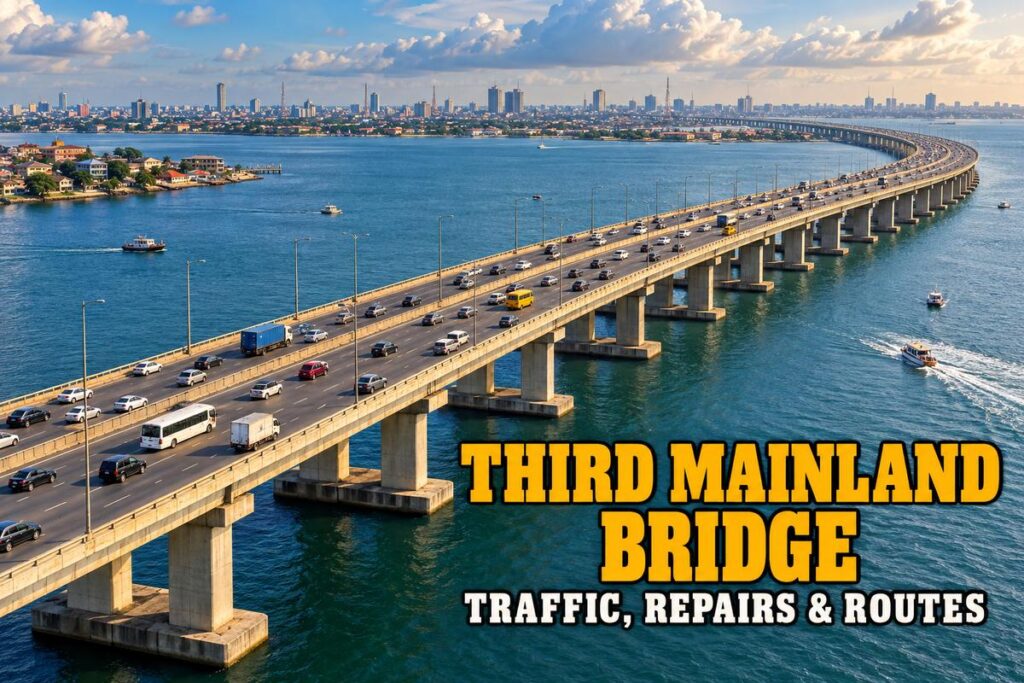
Few Lagos routes can change a journey as quickly as Third Mainland Bridge. A clear crossing can become a long queue after a breakdown, a lane restriction or congestion at the approaches, so the useful question is what affects your trip today.
This guide starts with the latest verified traffic and repair evidence, then explains the alternatives and the bridge facts that help put the route in context. It does not turn an old closure notice into a current announcement.
Is Third Mainland Bridge Open and What Is the Current Traffic Position?
A Lagos Traffic Radio report dated 11 October 2026 described movement around Adekunle, both inward and outward Third Mainland Bridge, as flowing well. That is recent evidence of traffic movement, not an all-clear for every lane at the moment you leave home.
The bridge should not be described as completely closed merely because an older repair notice appears in search results. However, current journey conditions still need a same-day check. Look at the direction, affected section and time on a traffic update before applying it to your trip.
Heavy vehicles also need separate attention. A federal works notice in August 2025 restricted heavy-duty traffic for structural-maintenance reasons. A withdrawal of that restriction was not verified in the material checked for this guide, so truck operators should obtain current official routing instructions rather than infer permission from ordinary passenger traffic.
The immediate planning task is to check the full journey, including the mainland approaches and Island exits. A report saying Adekunle is clear does not establish that a later junction, Victoria Island destination or airport access road is also moving freely.
Third Mainland Bridge Repair Updates in Context
Major surface rehabilitation led to reopening in April 2024. Later maintenance attention has included underwater structural elements, which are different from resurfacing the road deck. A repaired surface does not mean every long-term maintenance requirement has ended.
Federal works information in 2026 continues to discuss the defective underwater elements and the intervention being considered. Those engineering updates should be read alongside any actual traffic-control notice. They do not automatically establish a blanket closure of every carriageway.
The ministry has also described camera monitoring above and beneath the bridge. Monitoring can help oversight, but it should not be treated as a guarantee that a breakdown, fire or other incident will be resolved immediately.
| Information Type | What It Tells You | What It Does Not Establish |
|---|---|---|
| Surface-repair reopening | A particular closure or repair stage ended | That no future maintenance is needed |
| Underwater engineering update | Structural work or assessment is being addressed | A closure unless traffic restrictions are expressly stated |
| Traffic report | Conditions in a named area at a named time | Conditions for the rest of the day |
| Heavy-vehicle restriction | Certain vehicle types need another route | A total ban on all passenger traffic |
Check the publication date inside the notice. Search engines can display a recent crawl date for a report about repairs years earlier. The same caution applies to a forwarded video that gives no date or location for the scene.
Third Mainland Bridge Alternative Routes
Eko Bridge
Eko Bridge is an alternative mainland-to-Island crossing for some starting points and destinations. It may be more convenient for a journey approaching through the Ijora or Surulere side, but its own repairs, traffic and vehicle restrictions need checking.
Do not reroute solely because the distance looks shorter. Congestion at the approaches can erase the benefit, and temporary work on another bridge can change the available carriageway. Use a current route comparison and follow official diversion signs.
Carter Bridge
Carter Bridge is another connection associated with the Iddo and Lagos Island approaches. It can suit certain journeys, but it should not be treated as a permanent unrestricted fallback. The federal government announced a new Carter Bridge construction project in May 2026, so current access arrangements matter.
Ask whether the proposed route is available for your vehicle and direction before committing to it. A map can show the bridge line while failing to explain a temporary restriction or a queue at an approach.
Changing the Departure Time
Sometimes the better alternative is waiting for a reported incident to clear or travelling outside the busiest period. That option is useful when the appointment is flexible. It does not work when delaying departure would make you miss an airport check-in deadline.
For a trip involving Ikoyi and Lekki after the mainland crossing, our Lekki-Ikoyi Link Bridge guide explains that separate connection. It is not a substitute mainland crossing, so do not compare it with Eko or Carter Bridge as though they perform the same role.
Why Third Mainland Bridge Traffic Varies So Much
The bridge is only one part of the road network carrying mainland commuters towards the Island and back. Queues can form where traffic enters, leaves or merges, even when the open stretch of the deck looks uncongested.
Commuter direction also matters. A report about traffic moving towards the Island may say little about the opposite carriageway. Ask a precise question: which direction, which approach and what time? That is more useful than saying the bridge is always busy or always clear.
Rain, incidents, school movement and events can add to ordinary congestion. A driver who completed the crossing quickly yesterday has not established today’s travel time. Check again before departure and allow a buffer when the destination has a strict arrival deadline.
Avoid promising a fixed ten-minute or twenty-minute crossing to somebody visiting Lagos. The moving section may be quick, while the full journey includes a much longer queue. Give a live route estimate and explain that incidents can change it.
Getting to the Airport or an Island Appointment
Plan backwards from the time you need to finish check-in, rather than from the flight departure. Include the crossing, the airport approach, the terminal and baggage processing. Reaching the airport complex is not the same as reaching the correct airline counter.
If a restriction is reported, compare the alternative route before you leave a useful junction. A late diversion can add local traffic and make the journey harder. Avoid sudden lane changes when a navigation app offers a different route.
For a Victoria Island visit, include the final Island roads in the estimate. Our Eko Atlantic City access and directions guide is useful when that development is the destination. Confirm the entrance and host arrangements so the bridge journey does not end at the wrong gate.
Arrange a pickup around the actual arrival time, especially when meeting somebody from a flight. A driver waiting at the wrong terminal or a passenger waiting at a vague location can turn a manageable delay into a longer one.
Third Mainland Bridge Facts and History
Third Mainland Bridge is approximately 11.8 kilometres long and crosses the Lagos Lagoon, connecting the mainland road network with Lagos Island. Its commonly used name distinguishes it from other mainland-to-Island bridges in Lagos.
The first construction phase opened in 1980, and the completed bridge was commissioned in 1990. It is a long concrete road viaduct, rather than the cable-stayed type represented by the Lekki-Ikoyi landmark.
The bridge is important because it carries major commuter movement between residential areas on the mainland and commercial destinations on the Island. Its usefulness comes from the connections at each end as much as the length of the crossing.
It should not be advertised as a pedestrian sightseeing attraction. Enjoy the lagoon view as a passenger without asking a driver to stop on the deck. A photograph is not a good reason to create a hazard on a busy road.
Driving and Breakdown Preparation on Third Mainland Bridge
Check fuel, tyres and basic vehicle condition before a long Lagos journey. A breakdown on a bridge is more awkward than one outside a petrol station, and the consequences can affect many other road users.
Keep a charged phone available and identify your location carefully when requesting assistance. The direction of travel and nearest recognisable approach help responders more than a vague message saying you are on the bridge.
If the vehicle develops a problem, use hazard lights and move out of the traffic flow where safely possible. Do not attempt a dangerous repair beside moving vehicles. Seek appropriate assistance and follow instructions from traffic officers or emergency responders.
Keep passengers away from the carriageway. If a fire or immediate danger develops, prioritise moving people to a safe place and contacting emergency services. Do not remain close to a burning vehicle to collect photographs or belongings.
For urgent traffic-related reports, the Lagos government publishes the LASTMA toll-free contact 080000527862. Recheck the official service details when needed, and describe the incident and location clearly.
Frequently Asked Questions
Is Third Mainland Bridge Permanently Closed?
Recent traffic evidence shows movement, while restrictions can apply to particular sections or vehicle classes. Check the latest official notice and same-day conditions for your direction.
Are Eko and Carter Bridge Always Faster?
No. Their approaches and current work can create their own delays. Compare a live route estimate and check restrictions before diverting.
Does a Repair Update Mean the Whole Bridge Is Shutting?
Not necessarily. Engineering work and a traffic closure are different announcements. Read the affected section, vehicle type and timing in the actual notice.
Check the Whole Route Before Leaving
Third Mainland Bridge remains a major part of Lagos travel planning, but a useful decision needs current information for your direction and vehicle. Check repairs and restrictions, compare the full alternative journey and leave enough time for the roads beyond the crossing.


Leave a Reply